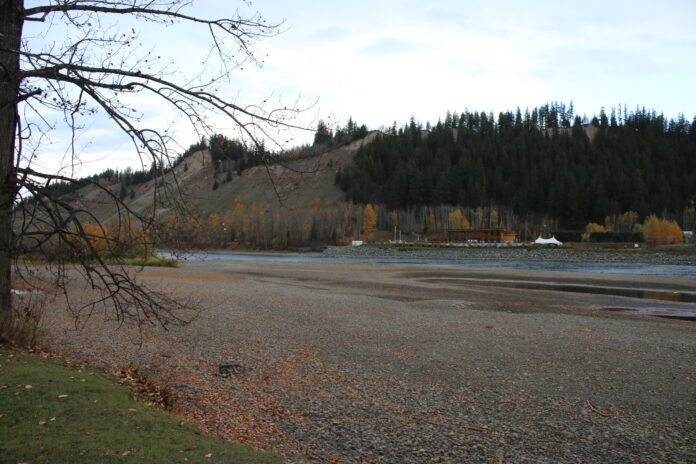
As of October 12th, a large part of Northern BC is still at level four or five drought conditions.
According to BC River Forecast Centre Hydrologist Jonathan Boyd, the Prince George area received approximately 350 millimetres of rain instead of the typical amount of 580.
“The rainfall just hasn’t been what we would normally expect, and that has led to a situation now where flows are very, very low,” Boyd said.
“It’s a little bit tricky because we typically don’t keep track of the drought over the winter, but at least heading into the winter, it’s not looking great, because this time of year, it’s not quite as wet as the coast, where we get fall storms that can replenish the water supply.
Boyd said the unusual part of this year was how quickly the drought kicked in.
“Partly it was related to the lingering drought that occurred last year. The snowpack, I would call it around normal to maybe slightly below normal, it certainly wasn’t a dramatically low snowpack,” Boyd said.
“April actually was a little bit of a cool month so there was a delay in the melt of snow, but May kicked in, and just how hot and dry May was led to the quickest melt we’ve recorded at our automated snow weather stations over maybe the past 50 years or so.”
He said flows were very high in May and June, but plummeted quickly after.
“By far this was the most drastic province-wide drought situation, and really was reflected with the unfortunate wildfire season as well.”
Boyd added during the winter, the demand for water is less, but there’s still risks.
“There could be potential risk for freezing of rivers completely, just the potential for ice jam flooding, which are really specific challenges with maybe the lower ground water levels,” he explained.
Boyd said BC is moving into an El Nino season, which typically leads to warmer winters for the province.
“It can vary, sometimes we do have the driest and lowest snowpacks in El Nino, sometimes we actually have very high snowpacks,” he said.
“It’ll be the low and mid-elevations where the expectation is there’ll be a little less snow accumulating because it might fall more as precipitation.”
He added it would take massive rainstorms from the coast spilling over into the interior to alleviate the drought conditions before winter starts.
“The likelihood is that the drought conditions will continue through the winter, and revolves around how much snow will fall in the winter season, combined with the potential and hope that more seasonal precipitation will occur in the March to June period.”
Boyd said it would take a normal to slightly above normal snowpack to help alleviate conditions throughout the winter.
“It’s all just variable on the exact location everywhere, but I think of last year, when the snowpack was maybe normal around April 1st, but we had a really cold, wet spring,”
“With that the snowmelt got delayed and by the time we got into the later season, relatively speaking, it was very high above normal.”
Boyd added the BC River Forecast Centre, will continue to monitor drought conditions over the next few weeks, and a decision will be made on if they will continue to monitor it through the winter.
Something going on in the Prince George area you think people should know about?
Send us a news tip by emailing [email protected].


