


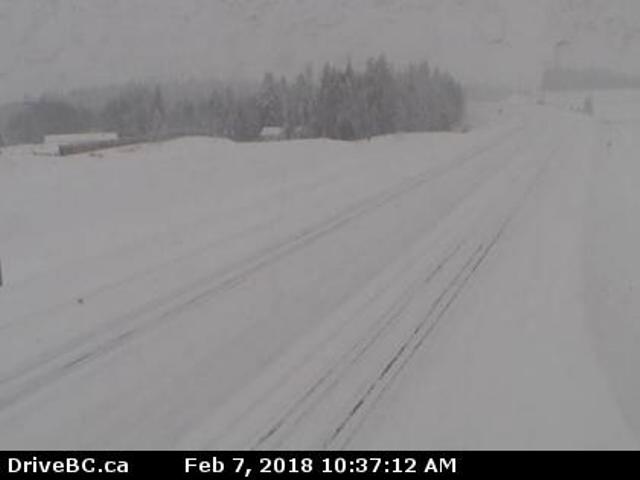
Drive BC has issued travel advisories for many Cariboo Highways as the second day of a Pacific frontal system continues to deliver heavy snow to the region.
Environment Canada meteorologist, Lisa West says although no records were broken Tuesday, today could very well see the opposite.
“In terms of today’s record what is now currently standing at under 12 centimetres set back in 1985, and our forecast for the Williams Lake area is anywhere from about 15-25 centimetres today,” she says.
Between 14 and 22 centimetres of snow was recorded, according to West, up until Wednesday morning within the Williams Lake and Quesnel area.
West adds that the region will not be done with the snow until Thursday.
“We’re still expecting at least light snowfall in through the evening and perhaps intensifying overnight as that low finally passes through and heads southeastwards,” she says.
“We’ll be seeing some snow right through until tomorrow afternoon when the Arctic front finally pushes through the central interior. We’re going to be trading our significant snowfall for a significant drop in temperatures.”
With the significant snowfall, Quesnel RCMP Staff Sgt. Chris Riddle recommends motorists to give themselves plenty of time to get their destination and drive to the road conditions.
“Every time there is snow and the conditions change, we do attend more collisions,” he says.
“People need to slow down and drive to the current road conditions because they can vastly change between communities.”
– with files from Rebecca Kelli, My Cariboo Now
.@DriveBC asking #CityOfPG drivers heading south on #BCHwy97 to drive to the conditions; travel advisories in effect across the Interior | #BCWeather #BCStorm https://t.co/PRvaKXr9Mw
— My Prince George Now (@mypgnow) February 7, 2018
Something going on in the Prince George area you think people should know about?
Send us a news tip by emailing [email protected].


